Author Topic: Paul & Matt tour WA, ID, MT, AL, BC  (Read 8182 times)

Offline Red01

  • Board Homesteader!
  • ***
  • Posts: 8977
  • Are we having fun yet?
Paul & Matt tour WA, ID, MT, AL, BC
« on: August 02, 2005, 01:27:05 AM »
4 days, three states, two provinces, two countries & 1500+ miles of OUTSTANDING roads!

Matt (Bobcat) and I took more pics than we did on last year's trip, but we still didn't take enough... partly because once you get going on these roads, you're having too much fun to stop and take pictures.

Note: This write-up will refer to routes in WA & BC as rated by the Destination Highways books where applicable. For those not familiar, the numbers refer to how highly rated the DH folks rate the road. Primary rated roads are noted DH-# and secondary routes near a DH are called "Twisted Edges" - or TE. One of the goals of this trip was to travel as many DH routes as we reasonably plan into our general destination. Clicking on the DH links in my write-up will take you to a page that tells a little about the road. Many of them have videos of sections of the road being ridden. (I got video on all the DH links except the first two WA ones, DH-1 & DH-29)

DAY 1: Tuesday, 7-26-05 (Camano Island/Stanwood, WA to Priest River, ID, ~500 miles.)

Left the house at 6:45am and met up with Matt at his place at 7:05. Since we had a lot of miles planned for Day 1, we took the quick way from Stanwood to Marblemount via I-5 and SR20 instead of one of our more usual backroad routes. We topped off tanks in Marblemount and continued on SR20, 
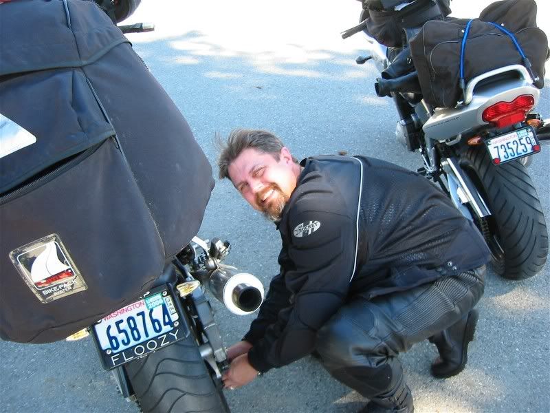
DH-1 (WA) to Winthrop, WA. We didn't stop for any photo ops on this stretch as we've both taken pics of this route before and I've posted them before. Well, I take that back. We did stop in Winthrop so I could make an adjustment to my brand new chain and Matt captured the moment:


After the chain adjustment, we continued on SR20, over Loup Loup Pass to Omak, which is DH-29 (WA). We left SR20 in Omak after fueling bikes and bodies and headed east on SR155 to Nespelem, DH-69 (WA).

In Nespelem, we hooked up with a twisty little county road called Cache Creek Road, DH26 (WA), that started off with a good dose of switchbacks and took us east to SR21.

We took SR21 north a few miles to Bridge Creek Road, 
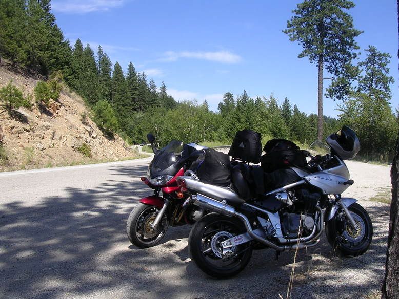
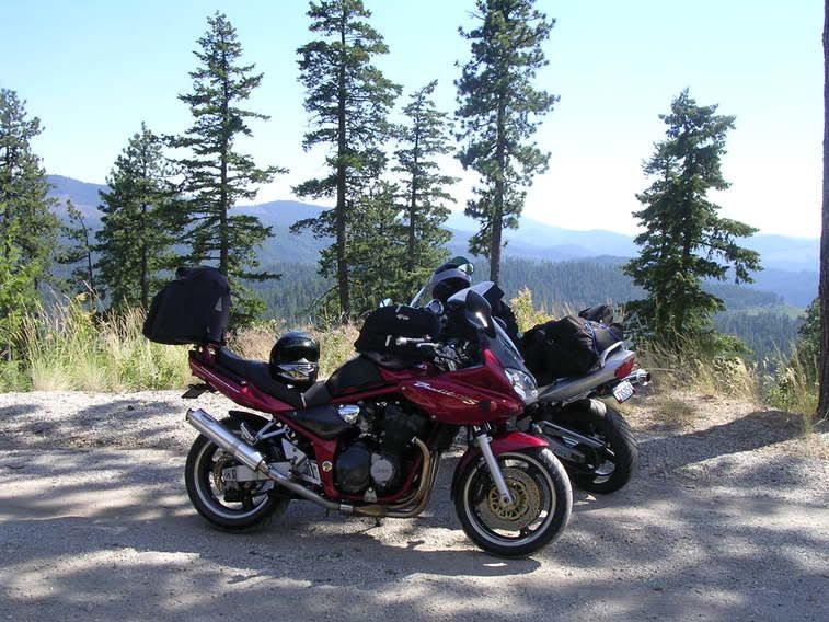
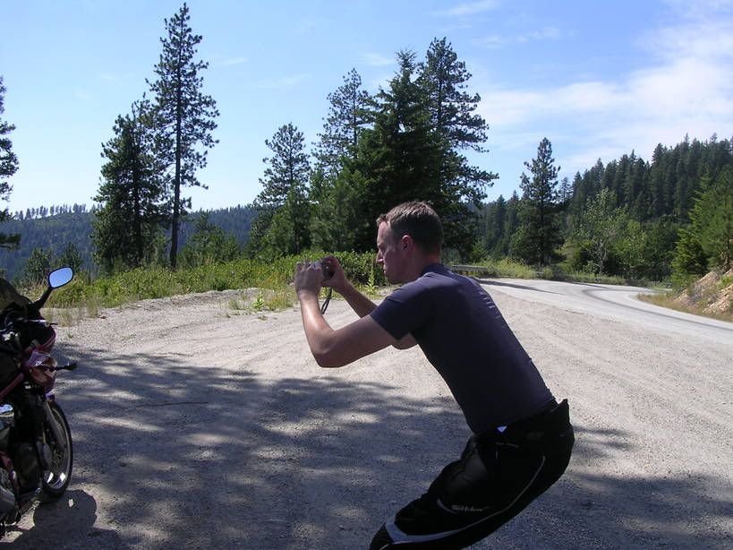
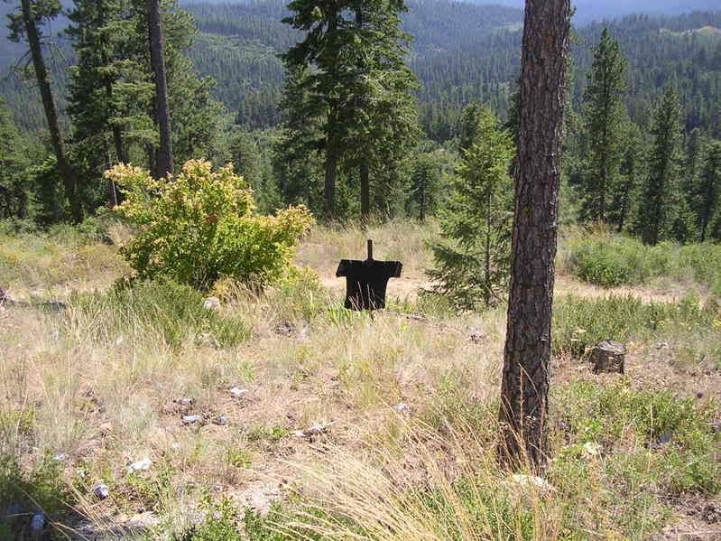
DH-23 (WA), where we continued eastward. This road started out with a few miles of fresh chip seal, but fortunately, not many curves were ruined from being trapped behind the cages we were stuck behind due to the flagger. This road was full of great curves, but pavement quality was lacking - probably due to it being low on the priority list for repairs in this sparsely populated part of the state. We stopped for a little break in a pullout on one of the sweepers to take in the view.


Paul's picture of Matt taking a picture:


Matt looked down the embankment and spotted a decorated and seemingly well celebrated (note the quantity of beer cans) roadside grave marker.


I strolled down to the cross and discovered a piece of paper under a rock at the base of the cross. Rain and sun had taken their toll on most of what was written, with only the title "Han Project" still readable...
Paul
2001 GSF1200S
(04/2001-03/2012)
2010 Concours 14ABS
(07/2010-current)


Offline Red01

  • Board Homesteader!
  • ***
  • Posts: 8977
  • Are we having fun yet?
Day 1 - continued
« Reply #1 on: August 02, 2005, 01:32:13 AM »
DAY 1 - part II

Once we reached the tiny community of Inchelium at the end of DH-23, we boarded Washington's only free ferry for a ride across the Columbia River/Roosevelt Lake.


Here I am doing a little route reviewing on the crossing:


Once on the other side it was a short jaunt north on SR25 to Gifford (a store and a few houses) where we hit the Addy-Gifford Road, TE-A & TE-B of DH-45, the first part (TE-B) which was great!


The last part, ~75% of TE-A, was pretty bad though! All the pavement had been removed and left us in dirt... with lots of ruts, potholes, soft spots and other not-so-fun hazards. Matt wanted to kill me for not heeding a sign that suggested an alternate route as soon as he realized this wasn't a short stretch of construction, but 5-6 miles. (Ironically, the alternate is labeled TE-A Alt in the DH book.) I had ignored the sign since the sign at the beginning of TE-B had warned of construction that never materialized - I just figured it was more of the same.

The driver of the pilot SUV informed us of fresh chipseal on SR20 east of Colville, so we decided against that route and once in Addy, we went south on US395 to Chewelah where we paused at the local car wash to clean the mud, dirt and bugs off the bikes before continuing on to Deer Park where we stopped for food & fuel again, then headed east on a county road a few miles and hooked up with US2. We then followed US2 eastbound (actually in a north, then NE direction) to the WA/ID border and stopped for the night about seven miles into Idaho, in Priest River.
Paul
2001 GSF1200S
(04/2001-03/2012)
2010 Concours 14ABS
(07/2010-current)


Offline Red01

  • Board Homesteader!
  • ***
  • Posts: 8977
  • Are we having fun yet?
Day 2 - part I
« Reply #2 on: August 02, 2005, 05:30:11 AM »
DAY 2: Wednesday, 7-27-05 (Priest River, ID to Pincher Creek, AL ~360 miles)

We took off from Priest River and followed US2 in its northeasterly direction and stopped for a photo op just past Bonners Ferry of the Moyie River Bridge. (The river is over 450 below the road surface.)


After crossing into Montana a few miles later, US2 heads southeasterly. Speed limits in Montana are more generous - with highways getting 70mph limits. (Freeways go up to 75 now, the days of no speed limit on freeways is gone - but that didn't matter to us since we weren't using their freeways anyway.)

Not too far from Troy, MT we stopped for the cameras again alongside the Kootenai River.


We continued to carve up US2 thru Kalispell (where we had originally set the goal to be by the end of Day 1) and on to West Glacier.
Paul
2001 GSF1200S
(04/2001-03/2012)
2010 Concours 14ABS
(07/2010-current)


Offline Red01

  • Board Homesteader!
  • ***
  • Posts: 8977
  • Are we having fun yet?
DAY 2 - part II
« Reply #3 on: August 02, 2005, 06:36:44 AM »
DAY 2 - part II

At West Glacier, we turned off US2 and entered Glacier Nat'l Park and the Going to the Sun Highway. Since it was the middle of the day, the traffic was heavy - even heavier than we'd anticipated - but beautiful, nonetheless. We did manage to find a few places to wick it up and enjoy this twisty delight.

As you enter the park from the west, you soon find yourself winding along the shore of Lake MacDonald.


Shortly after the road began to seriously climb, we were halted for construction.


Fortunately, we were close to the front, and soon were able to get by the two rolling pylons in front of us and got several miles of unobstructed road before the top of Logan Pass.
Paul
2001 GSF1200S
(04/2001-03/2012)
2010 Concours 14ABS
(07/2010-current)


Offline Red01

  • Board Homesteader!
  • ***
  • Posts: 8977
  • Are we having fun yet?
Day 2 - part III
« Reply #4 on: August 02, 2005, 06:57:10 AM »
Some shots just shy of the Logan Pass Summit:


We didn't stop at the overcrowded visitor's center at the summit, but we did stop and take some pictures about as far down the other side as we did before the summit.


...and the bottom half of the above pic...


Paul
2001 GSF1200S
(04/2001-03/2012)
2010 Concours 14ABS
(07/2010-current)


Offline Red01

  • Board Homesteader!
  • ***
  • Posts: 8977
  • Are we having fun yet?
Day 2 - part IV
« Reply #5 on: August 02, 2005, 07:30:37 AM »
After leaving Glacier NP - at least the part you have to pay to drive through - we headed north on US89 to the town of Babb (a store, cafe, motel and gas station) where we stopped for some black bean and buffalo chili - Mmmmm! Our waiter was wearing a T-shirt with "BABB" in large letters across the chest. I asked where I could get one and he said the store across the street had them... I was going to get one for Pete, but alas, they didn't have any left that were big enough to fit a grizzly bear.

Just out of Babb we turned off to the NW on SR17 and we were back into the fringes of Glacier NP until we hit the border at Port of Chief Mountain. No towns on either side here, just the US & CDN Customs Houses.


The border crossing was uneventful and easy.  :bigok:

On the Alberta side SR17 became AL6. We didn't go into the Waterton Lakes side of the Glacier/Waterton International Peace Park any further than what AL6 took us, but the scenery to our left - and later, our mirrors, was spectacular!


Shortly after we took the above pictures, we happened across this road sign:


The puzzling thing was the only thing I saw anywhere near the sign that resembled a road in that direction was a driveway maybe 100' long. Maybe it's a cathouse in the middle of the Southwestern Alberta Prarie?

We continued along AL6 to Pincher Creek, the first Albertan town of any consequence where we stopped for the dinner, some good Canadian beer and a good night's sleep.
Paul
2001 GSF1200S
(04/2001-03/2012)
2010 Concours 14ABS
(07/2010-current)


Offline Red01

  • Board Homesteader!
  • ***
  • Posts: 8977
  • Are we having fun yet?
Day 3
« Reply #6 on: August 02, 2005, 08:55:28 AM »
DAY 3: Thursday, 7-28-05 (Pincher Creek, AL to Christina Lake, BC ~410 miles)

We left our room In Pincher Creek bright and early, before our HD riding neighbor from Colorado was even stirring. At the north end of town, we turned off AL6 and headed west on secondary AL507. We chose this route as it would get us back into the foothills of the Rockies and out of the prarie sooner and would be less likely to be patrolled by the RCMP or local constables. AL507 then curved north and we joined AL3 and headed for the BC border. During out stay in Pincher Creek we had been evaluating the amount of tread life left in Matt's rear tire and decided not to go north to Banff, originally on our intenerary, but just take in as many southeastern BC DH's as possible on our route home.

Crowsnest Pass sits on the BC/AL border. Just before crossing the border was Turtle Mountain and the evidence spectacular natural disaster of 1903 known as Frank Slide, where 90 million tons of rock slid off the mountain and covered 1.2 square miles of land below in 100 seconds. Part of the town of Frank was buried in this slide and ~70 of the town's 600 residents perished. (We didn't take a pic, so I had to borrow this one from the web. It was a much nicer day when we went through.)


After crossing into BC, AL3 becomes BC3 and the next town on the map was Sparwood where we stopped at A&W Root Beer and had a bacon & egg breakfast. Next to the A&W was a small park that paid tribute to the town's main industry, mining.


From Sparwood, we continued down BC3 to Fernie and Elko, where it  is also DH-85 (BC). At Elko, we turned south and took BC 93 for a few miles to pick up Jaffray-Baynes Lake Road. The middle section of this road follows the NE shore of Lake Koocanusa and joins BC3 at the hamlet of Jaffray. We followed BC 3 west for just a few miles and turned off on the Wardner-Fort Steele Road, DH-53 (BC). At Fort Steele, we took BC93 the few miles back to BC3 and into Cranbrook.

Cranbrook is a pretty good sized town, big enough to have a Suzuki dealer (sharing space with Bombardier & Harley)... we stopped in to see if they had a tire in stock to replace Matt's Azarro. After finding out they had no Avons and getting some reassurance from the ZRX riding parts counter guy there was enough to make it back, Matt decided to continue on with what he had. We discussed the Destination Highways BC book with the counter guy and he was quite familiar with the book and reaffirmed the #1 rating of DH-1 (BC) and told us it was well worth the 100 or so miles out of the way it would take us to take it in, which I had every intention of doing anyway... so we left Cranbrook with a full tank of gas and continued down BC3 to Creston where we turned north on BC3A, DH-1 (BC), and took it up to Kootenay Bay and the world's longest free ferry ride across Kootenay Lake to Balfour.


Once on the other side of the lake, BC3A resumes thru the bustling resort town of Nelson. In Nelson, we turned south and followed BC6, DH-83 (BC), to Ymir and Salmo. In Salmo, we headed west on BC3B toTrail where we paused for a dip in the Kootenay River...


...in the little cove in the middle of this shot:


The hot sun quickly dried us off and we continued on to Rossland where switchbacks starting the climb out of the Kootenay River Valley started in town and BC3B is also DH-15 (BC) until it rejoins BC3 and we contuned west on what is also DH58 (BC).

About 2/3rd of the way thru the strech of BC3 that is DH-58 there's a little resort town just north of the US border called Christina Lake... that's where we decided to call it a day.
Paul
2001 GSF1200S
(04/2001-03/2012)
2010 Concours 14ABS
(07/2010-current)


Offline Red01

  • Board Homesteader!
  • ***
  • Posts: 8977
  • Are we having fun yet?
Day 4
« Reply #7 on: August 02, 2005, 09:52:21 AM »
Day 4: Friday, 7-29-05 (Christina Lake, BC - home ~325 miles)

We got a later start than the other days, but were still on the road by 8am and continued on BC3 into Grand Forks. Still on BC3, but the DH number changes here from DH58 to DH-79 (BC) until the town of Midway, where the DH folks have it unrated between Midway and Rock Creek. Rock Creek to Osoyoos it's rated as DH-24 (BC). This road is an absolute HOOT! Especially from the top of the ridge down into Osoyoos. That stretch was so much fun, once we got to the bottom, we rode back up to the top and rode back down again!

A view from the top, looking down into Osoyoos


The hairpin just past the Osoyoos sign


Descending down into Osoyoos:


Once into downtown Osoyoos, we turned south on BC97 and headed the couple of miles to the US border, where we had another trouble-free border crossing, continued into Oroville on US97 and grabbed brunch. After filling out bellies, we hit SR7, part of which is a portion of DH-34 (WA) and DH-34's TE-A into Tonasket, where we picked up SR20 into Omak and followed it on home.

All the shots in this write-up as well as the ones I did't decide to post (in no particular order) can be seen at:

http://s32.photobucket.com/albums/d35/paulweit/2005%20Bike%20trip/
Paul
2001 GSF1200S
(04/2001-03/2012)
2010 Concours 14ABS
(07/2010-current)


Offline fartndust

  • Board Homesteader!
  • ***
  • Posts: 64
Paul & Matt tour WA, ID, MT, AL, BC
« Reply #8 on: August 02, 2005, 04:09:04 PM »
Those are some spectacular pics!
I thought the special effects using the tiny scaled down version of the Bandit and the Tonka truck was pretty slick too :wink:
Some of the mountain/valley views are worthy of saving for computer backgrounds (so...I saved 'em!)
 :beers:
I was drinking at the time...so ya, I mighta said that.
IT'S ONLY FUNNY TILL SOMEONE LOSES AN EYE...Then hey! There's a free eye out there!
'02 Bandit 1200S  Me
'04 YFZ450  Me
'03 LTZ400 Wifey
'02 YFS200 Son
'04 Viper 90 Honeybun

Offline WEINERDOGBONE

  • Board Homesteader!
  • ***
  • Posts: 359
Paul & Matt tour WA, ID, MT, AL, BC
« Reply #9 on: August 02, 2005, 05:41:40 PM »
That was beautiful. I've had it with corn and soybean fields. I'm moving! :crybaby:

Offline PeteSC

  • Board Homesteader!
  • ***
  • Posts: 2525
    • SouthChinaLady
Paul & Matt tour WA, ID, MT, AL, BC
« Reply #10 on: August 02, 2005, 05:57:35 PM »
Hey Paul, your Bandit wouldn't make much of a tire chock, but I'm sure the locals appreciate the effort. :duh:

  How was the weather?   What was the temperature range you traveled in?
 'Fess up, you were riding with those cruisers, weren't you? :motorsmile:
Spartanburg, SC
'99 Bandit 1200
'03 DR650
I'm really a very hot, sexy,lesbian, trapped in this fat, middle-aged, male body......

Offline Red01

  • Board Homesteader!
  • ***
  • Posts: 8977
  • Are we having fun yet?
Paul & Matt tour WA, ID, MT, AL, BC
« Reply #11 on: August 02, 2005, 07:05:36 PM »
I figured that dump truck could have run over my bike and not even felt it!

As you can see from any of the pics with sky in them, the weather was just fantastic. It was HOT! any time after ~10am. Mornings were cool enough to wear a sweatshirt under my JR AlterEgo with it's shell on and vents closed. Studying the weather patterns before we left revealed the overnight lows could dip down to the low 40's, so instead of bringing the JR's rain liner, I opted to bring my Gerbing heated liner, which is also waterproof, but I never had to use it for wet or cold. Daytime highs were in the upper 90's and possibly even over 100. Not real sure since I didn't bring a thermometer and there weren't many banks around with time/temp readerboards. It would dip down into the high 70's-low 80's at the higher elevations, like when we went over passes. Glacier was partly cloudy, but still nice and warm with low humidity levels.

I lived in Kansas for a few years, Weinerdogbone. Glad I'm away from those flatlands and farm fields! We have some of that here, but it's not the only thing to see. (All the green you see in the valley where Osoyoos sits is apple and cherry orchards.)
Paul
2001 GSF1200S
(04/2001-03/2012)
2010 Concours 14ABS
(07/2010-current)


Offline Banditboy600

  • Board Homesteader!
  • ***
  • Posts: 114
Paul & Matt tour WA, ID, MT, AL, BC
« Reply #12 on: August 02, 2005, 07:44:12 PM »
Great write up Paul!  Awesome pics, thanks for sharing them with us.  :)
Maybe next time you will find a shirt that will fit Uncle Peteeee!  Any mechanical issues other than the tire on Matt's bike?  Glad you had a great time!
Kevin R
'02 Bandit 600S (sold)
'05 FZ1 silver

Offline PitterB4

  • Administrator
  • Board Homesteader!
  • *****
  • Posts: 3698
Paul & Matt tour WA, ID, MT, AL, BC
« Reply #13 on: August 02, 2005, 07:58:51 PM »
Huh?  All that and no pic of the chick in the BABB t-shirt?????  

 :stickpoke:

Well, great write-up anyway.   :thanks:
Rob
Bikeless!
'93 Bandit 400 - SOLD
'98 Honda F3 Track Bike - SOLD
'98 Kawi ZX-6R Street Bike - SOLD
NESBA #87 - RETIRED
'00 Gary Fisher Kaitai
'09 Bianchi Via Nirone 7

Offline Red01

  • Board Homesteader!
  • ***
  • Posts: 8977
  • Are we having fun yet?
Paul & Matt tour WA, ID, MT, AL, BC
« Reply #14 on: August 02, 2005, 09:04:42 PM »
Quote from: "PitterB4"
Huh?  All that and no pic of the chick in the BABB t-shirt?????  

 :stickpoke:

Well, great write-up anyway.   :thanks:


Go back and read that part again, Rob... I didn't take a pic of the waiter. If you're really interested in tall geeky lookin' male college grad students workin' summer jobs near their favorite playgrounds, I'll keep that in mind on my next trip and take some pics just for you.  :wink:
Paul
2001 GSF1200S
(04/2001-03/2012)
2010 Concours 14ABS
(07/2010-current)